
Arrange your charge points on a site plan in Monta Hub: place EVSEs on a schematic grid or satellite map, add orientation markers, and preview what drivers will see.
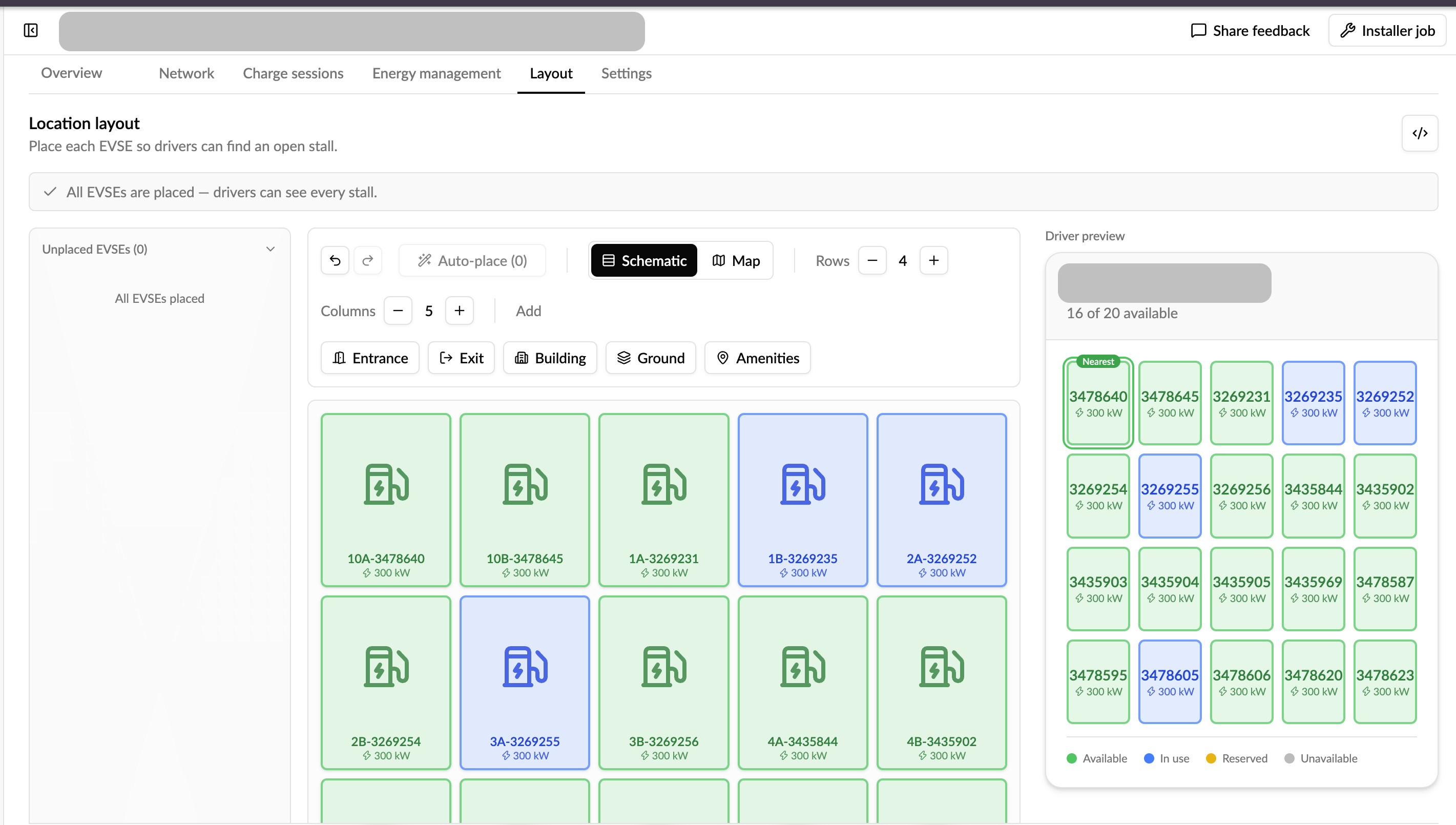
Location layout lets you arrange a site's charge points on a visual plan, so a driver can see at a glance where each stall sits and which one is free. You build it once in Monta Hub, on the location's Layout tab.
What you can do
- Place your EVSEs by dragging them onto the plan so they match their real positions on site.
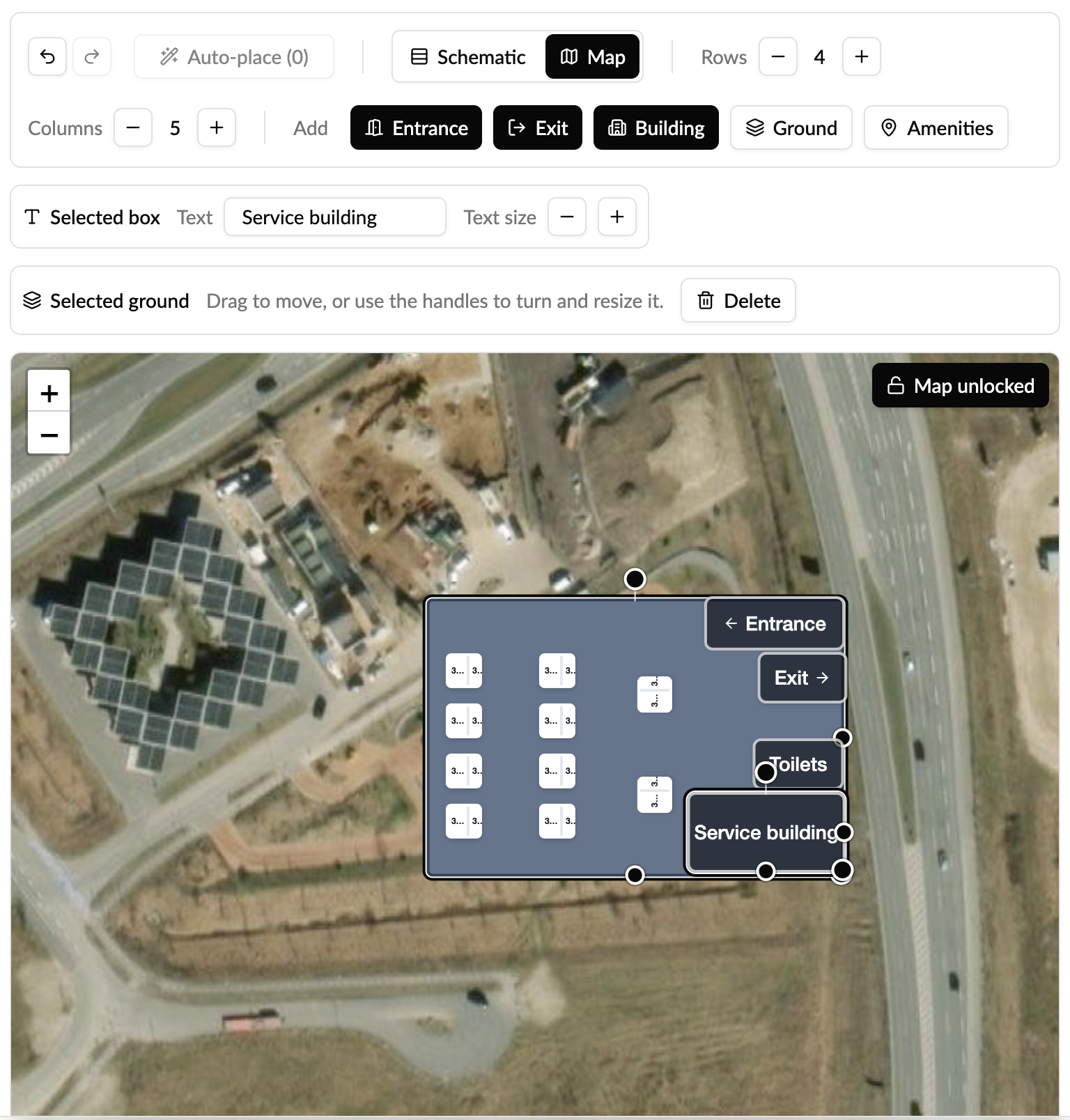
- Choose a backdrop: a simple schematic grid, or a satellite map where stalls are pinned to real coordinates.
- Add orientation markers that don't charge, such as an entrance, building, exit, or payment terminal, to help drivers find their way.
- Group a station's EVSEs together and move them as one unit.
- Resize and rotate stalls and markers so the plan reflects the real site.
- Preview what drivers will see before you publish, and share a preview link.
How to build a layout
- In Monta Hub, open the location and go to the Layout tab.
- Pick a backdrop: schematic grid or map.
- Drag your EVSEs onto the plan and position them; group a station's EVSEs where relevant.
- Add any reference markers (entrance, payment terminal, and so on).
- Save. Use the preview to check what drivers will see.
If you add or remove EVSEs later, the layout reconciles automatically: new EVSEs appear as unplaced so you can drop them in, and removed ones fall away.
Where drivers see it (first edition)
In the first edition, the layout is not shown in the Monta mobile app yet. You build and publish it in Hub, and drivers can view it through the shareable web preview. Bringing the layout into the mobile app is planned for a later release.
Frequently asked questions
Is this in the Monta app? Not in the first edition. The layout is authored in Hub and viewable via the web preview; in-app support comes later.
Can I use a real map instead of a grid? Yes. You can choose a satellite map backdrop and pin stalls to real coordinates, or use a simpler schematic grid.
What happens if I change my charge points after building a layout? The layout reconciles with your current EVSEs, so added ones show up as unplaced and removed ones drop out.
Who can edit the layout? Operators with update rights on the location. Viewing needs view rights.
Need help?
Contact Monta support from your Hub if you have questions about building a layout.